Ecuador in pictures
Its capital city is Quito. Colombia is bordered to the north, south and east with Peru and to the west by the Pacific Ocean. The country is crossed from north to south by a volcanic section of the Andes mountain range west of the present Gulf of Guayaquil and a wooded plain; and east the Amazon. The Ecuadorian territory includes ocean Galapagos Islands 1000 km from the coast. During the pre-Columbian era where human settlements existed in the Inca vestiges remain, Culture Las Vegas, Chobsi, and Amazon Cubilan paintings. It is the country with the highest concentration of rivers per square kilometer in the world, the most diverse per square on the planet kilometer and one of the most biodiverse countries taking countless plant and animal species, is currently the only country having in its constitution the right environment.
Ecuador is located on the earth's equator so their territory is in both hemispheres. Includes two remote spaces together: the northwest mainland of South America with some islands adjacent to the coast and the archipelago or island province of Galapagos, which is located 1000 kilometers from the coast of Ecuador in the Pacific Ocean.
The territory of Ecuador is divided into parishes (urban or rural), which form the cantons, these Provinces, and these Administrative Regions. Each of these entities and metropolitan districts have Autonomous Decentralized Government, responsible for executing policies within its scope.
The data generated by the INEC report that by March (2013) 15,936,100 people live in Ecuador. The 91,95% of the inhabitants say they have a religion, 7.94% defined themselves as atheist and 0.11% identified as agnostic. Within the group professing a religion the 80.40% defined themselves as Catholic and 11.30% as evangelical. Other religions mentioned by respondents were: Jehovah's Witnesses (1.29%), Mormonism (0.37%), Buddhism (0.29%) and Spiritualism (0.12%).
The economy of Ecuador is the eighth in size and Latin America experienced an average growth of 4.6% between 2000 and 2006.
For sightseeing, after the Ecuador Love Life campaign, this sector increased. The country has two towns Cultural heritage: Quito and Cuenca, and two natural heritage sites: the Galapagos Islands and Sangay National Park as well as a world biosphere reserve, as is the bulk of the boxes. Culturally, it is recognized the straw hats and culture of indigenous people Zapara.
The most frequented by tourists and foreigners have different shades due to the various tourist activities offered by the country.
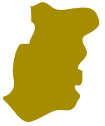
Azuay
Province located south of Ecuador, in the Andes in turn located in the Sierra Region Interandina or in its southern part.
Its capital is the city of Cuenca called the "Athens of Ecuador" with around 330,000 in the urban area. In this province is located the dam Daniel Palacios, in the river Paute, in addition to the Mazar and Sopladora projects, become the main supplier of electricity to the country.
The climate is variable due to height, from tropical to glacial due to the presence of the Andes and subtropical vegetation on the west, the province is climatologically fragmented into various sectors. It has 15 cantons.
Among its attractions is the historic center of Cuenca, El Cajas National Park, archaeological remains of Pumapungo, The Tarqui, among others. Their main festivals are: Cuy Festival (February), Peach Festival (March), Cane Festival (September), Bull Festival (October and November) and El Paso del Niño (December).
Esmeraldas
Located on the northwest coast, popularly known as the green province. His eponymous capital is one of the main ports of Ecuador and the trans-Andean pipeline terminal. It has an airport for domestic and international flights.
Much of its economy depends on the export of shrimp and bananas. Besides this, cacao, coffee and snuff occurs. There are important fisheries, petrochemical industry and tourism. It has crafts carving black coral, fabric tree (damahagua), rampĒra basketry and musical instruments.
Its main attraction is its coastline and beaches as well as its ecological reserves such as the ecological reserve Cayapas Mataje at north; all make the province one of the most visited tourist destinations in the country.
Esmeraldas has forests of mangroves highest in the world, these are located north of the province (San Lorenzo) close to the border with Colombia.
Carchí
Amilcar Tamayo Tapia notes that the word is chibcha origin and that "car" is equal to limit, control, strip separating possessions, and "chi" is equal to water, so it would be limit of water.
Bordered to the north, the San Juan river and Carchi river serve him as a border with Colombia, south borders the province of Imbabura, the east by the province of Sucumbios, and west to Esmeraldas. It has 6 cantons.
The lead agency for the promotion and development of tourism in the Carchi is the Provincial Department of Tourism. The main and most attractive places for tourism are: El Angel Ecological Reserve, Chiles Volcano, Tufiño baths, Grotto of La Paz, Bioanthropology Book Awa, La Laguna del Salado, Cemetery Johannesburg, among others.

Imbabura
It is a province of the Northern Sierra of Ecuador, known as the "Province of Lakes" by the number of large lakes found within the province, such as Lake San Pablo and gaps Cuicocha Yaguarcocha ("Lake of blood") and Puruhanta in Pimampiro and other minors: lake San Marcos, Piñán ponds, lakes of Mojanda and Laguna Negra between Sigsipamba and Monte.
It has two climatic zones: the first warm and dry or steppe, known as the Hoya del Chota where the capital is also Ecuador and the Andean subtropical warm, known as Intag and Lita (border with the province of Esmeraldas).
Its main tourist attractions are: Cotacachi Cayapas Ecological Reserve, Lake San Pablo, Yahuarcocha Lagoon, Historic Center of Ibarra, Ibarra Spanish Ville, Ibarra Portuguese Colony, The meadows and steppes of Ibarra, Yuracruz and Los Andes Ibarreños, the Expometrópoli Ibarra, The Reeds of Ibarra, Montes Secos and Montes de la Dehesa Ibarreña, Religious of Ibarra, among others.
Pichincha
It is located north of the country, in the geographical area known as Sierra. Its administrative capital is Quito, which is also the most populous city and the capital. It is also the main commercial center of the country. It is divided into 8 cantons. In the province there are two distinct areas: the east, an area dominated by the eastern and western Andes area; the west, an area that belongs to Costa, which is populated by subandinas ramifications.
It is the largest administrative, economic, financial and commercial heart of Ecuador, as it is home to almost all government agencies, banks and 60 of the 100 largest companies in the country. The province takes its name from the eponymous active stratovolcano located north of the center, in the capital Quito.
Its tourist attractions include: Historic Center of Quito, Mitad del Mundo, Basilica of Our Lady of Quinche, Cayambe Volcano, among others.
Sucumbíos
It is a province of north-eastern Ecuador. Its capital is Lago Agrio, provide the State oil needs for exports. It is characterized by its beautiful scenery Amazon, including Aguarico. In this province is located the Reventador volcano (3562m). Its main rivers are from the Andean Cordillera Oriental. Among them are the San Miguel, Putumayo, Cuyabeno, Cofan, and G³epí Aguarico.
In the upper area the climate is paramo, and as it descends to the Amazon rainforest, it has modified due to altitude, humidity and wind, making it a very hot humid tropical climate.
The main tourist attraction is the Sucumbios Cuyabeno Lagoon, in the area of Putumayo, which has an important wildlife reserve. Touristically force the province wildlife.
Manabí
Its capital is Portoviejo. Bordered on the west by the Pacific Ocean, north of the province of Esmeraldas, on the east by the province of Santo Domingo de los Tsáchilas and Los Ríos, south of the province of Santa Elena and south and east by the province of Guayas. It has a pleasant climate between temperate - tropical - subtropical dry and subtropical.
In tourism geography is characterized by cliffs, rivers, estuaries, islands, rocks and slabs showing beautiful scenery along our coastal geography, which is the main attraction of our province region. Some sites include: Caráquez Bay, San Vicente, Chirije, Cojimíes, Pedernales, Punta Palmar, Jama, El Matal, Canoe, Don Juan, Briceño, Puerto Cayo, San Jacinto, San Clemente, Crucita, The Bat, St. Marion, San Lorenzo, Machalilla, Los Frailes, Puerto López, Salango, Ayampe.

Cotopaxi
In the highlands region of the country, the center - north. Its capital is Latacunga. The province is named after the largest and most important of its territory volcano, Cotopaxi volcano.
Cotopaxi is divided into 7 cantons. According to the latest land use, Cotopaxi province belongs to the center also included the provinces of Pastaza, Chimborazo and Tungurahua region.
Cotopaxi has a large number of indigenous people who are engaged in agricultural work . Among its tourist attractions are: Church of El Salto, San Agustin Church, Church of Santo Domingo, home of the Marquis of Miraflores, Party of Black Mama, Cotopaxi National Park, Quilotoa Volcano, Laguna Yambo, Saquisilí Fair, the Cerro Callo, Pachusala Ruins, El Tambo Mulaló, among others.

Santo Domingo de los Tsáchilas
The province takes its name from the Tsáchilas, ancestral ethnic group in the area. Its capital is the city of Santo Domingo also known as "Santo Domingo de los Colorados" by the custom of the Indians Tsáchila hair painted red with achiote.
Bordered on the north and east by Pichincha, northwest to Esmeraldas, on the west by Manabí, south and southeast Los Rios with Cotopaxi. Northwestern part of Ecuador, is one of the areas with the highest rainfall in the country. It has a great abundance of water, there are five major river basins and watersheds.
It has numerous tourist attractions such as: Botanical Garden "Padre Julio Marrero," San Vicente del Commune, Nila Cathedral, the "Good Shepherd" and Bombolí Shrine, dedicated to the Assumption of Mary.

Napo
Located in the Ecuadorian Amazon region and including part of the slopes of the Andes to the Amazonian plains. It takes its name from the Napo River. Its capital is the city of Tena. It limits to the north with Sucumbios, south with Pastaza, on the west by Pichincha, Cotopaxi and Tungurahua and east by the province of Orellana.
Among its tourist attractions is the cathedral of Tena, La Isla Amazon Park(Parque Amazónico La Isla, PALI), Monument Jumandy, among others.
Orellana
The capital of the province is known as The Coca "Coca ". To the north it borders with Sucumbios, to the south with the province of Pastaza, Peru on the east and west by Napo. It is one of the newest provinces, 22 provincial, as it was created in 1998 to be separated from Napo. The population is 136,396 inhabitants; its native inhabitants belong mainly to the nationalities Waorani and Kichwa Schuar.
Among its main attractions we can mention the Yasuni National Park, declared a UNESCO Biosphere Reserve, the Sumaco volcano surrounded by a large biodiversity and natural view of the Amazonian plateau. Coca is a resort, where the Cathedral of Our Lady of Mount Carmel is located, Lagoon Taracea, the resort Samana Huasi Museum CICAME, botanical garden Mushu Yura, Pañacocha and Napo River are part of the attractions.

Los Ríos
Its capital is the city of Babahoyo and its most populous city is the city of Quevedo. It is one of the most important agricultural centers of Ecuador. With its 778,115 inhabitants, Los Rios is the fourth most populous province in the country, mainly due to the recent development of the industry. His most important and populated cities are: Quevedo, Babahoyo, Buena Fe, Ventanas, Vinces and Valencia. Their territory is located on the central coast of the country and borders the provinces of Guayas, Santo Domingo de los Tsáchilas, Manabi, Cotopaxi and Bolivar. Los Ríos is divided into 13 cantons.
Among its attractions: Wetland Abras Butter in Vinces, Cacharí The hill and its curious Structure Babahoyo, Pedro Franco Dávila Biological Station in Jauneche, The beaches of La Reveza in Palenque, Vinces beaches, Boardwalk Babahoyo, among others.

Bolívar
Named in honor of the Libertador Simón Bolívar. Province of central Ecuador in the western Andes. Its capital is the city of Guaranda. It has an area of 3,254 km², making it the smallest province of Ecuador. No major elevations, except the Chimborazo Volcano is partly in this province. It has 7 cantons.
Among its tourist attractions is: Cacique Guaranga Monument, Historical Museum, El Camino Real, The Virgin in the Grotto of Lourdes, Sanctuary of our Lady of Huayco, Salt Mines, Guaranda Carnival, Fiesta de Reyes, among others.

Santa Elena
Santa Elena is a province of the coast of Ecuador created on November 7, 2007, the most recent of the current 24, with territories prior to that date were in the Guayas province, west of it.
Its capital is the city of Santa Elena. This province has a large hotel infrastructure, an oil refinery, airport and seaport.
Santa Elena is known internationally for Salinas beach and the beach of Montanita.
Guayas
Located in the coastal region of the country, southwest of it. Its capital is the city of Guayaquil. It is the largest industrial center of Ecuador. It is the most populous province and named after the largest and most important river in its territory , the Guayas River.
Bordered on the north by the provinces of Manabi and Los Rios, south to the province of El Oro, as well as the Gulf of Guayaquil, on the east by the provinces of Los Ríos, Bolívar, Chimborazo, Canar and Azuay, and west with the province of Manabi, the province of Santa Elena, and the Pacific Ocean. The influence of the Humboldt cold and warm currents of El Niño produced the climate of the province of Guayas is the tropical savannah and tropical monsoon type, with high temperatures during most of the year .
The current territories of Guayas were dominated in pre-Columbian times by huancavilcas and several other tribes.
The main tourist attractions of the province are scattered throughout the territory. In the capital stands the Malecón 2000 and the Malecón del Salado. There is also the Santa Ana hill, which is regenerated and redeveloped for tourism.

Cañar
It is located south of the country, in the geographical region known as Sierra. It has an area of 3,908 km² and a population of 225,184 inhabitants. It is one of the oldest provinces of Ecuador, created in 1825 under the government of Ignacio de Veintimilla. Azogues City is the provincial capital.
The province stands out as one of the most important tourist sites in the country, highlighting among others the Fortress of Ingapirca, Lagoon City Culebrillas and Azogues.
Its climate is paramo on the high plateaus; humid and semi-humid inside the province and tropical monsoon in the lower parts of the western foothills mesothermal.
Chimborazo
Located in the central area of the inter hall, known as the "province of the high peaks," because it holds some of the highest peaks in the country, as the Carihuayrazo, Altar, The Igualata, Tungurahua, the Sangay, among others, in some cases shared with other provinces and has 10 cantons. In the western range is the Chimborazo volcano, which gives name to the province and with a height of 6,310 meters, it is the highest elevation in the country.
Bordered on the north by the province of Tungurahua, south to the province of Canar, on the west by the provinces of Guayas and Bolivar, on the east by the province of Morona Santiago.
Among its attractions are: Chimborazo Nevado, El Altar Nevado, Hot Springs of Guallabamba and Cunug Pugyo, Nose Devil, Punín Paleontology Cemetery, Riobamba Cathedral, Museum of the Convent of La Concepción in Riobamba, Balbanera Church, among others.

Tungurahua
It is the center of the country, in the geographical region known as Sierra. The city of Ambato is the administrative capital; is divided into 9 cantons. Part of the region is also comprised of the provinces of Cotopaxi, Chimborazo and Pastaza. The province takes its name from the eponymous active stratovolcano.
Among its tourist attractions are: The Liria Atocha Botanical Garden, The historic home Martínez-Holguin Provincial Park Family, Spas Aguájan, "The Rock River" ecological paths, Pinllo, Ficoa Church Cathedral, Church of the Miraculous Medal, among others.
Pastaza
Named after the Pastaza River, which separates the southern province of Morona Santiago. Its capital is the city of Puyo.
Bordered on the north by the provinces of Napo and Orellana, Morona Santiago to the south, the east with Peru and to the west by the province of Tungurahua. Pastaza is an area of fluvial present precipitation throughout the year, the climate is warm and humid.
Morona Santiago
It is a province of the Ecuadorian Amazon. Its capital is the city of Macas, which also is its most populous city. Its territory Pastaza bordered to the north, south to Zamora Chinchipe, the east with Peru and to the west by Tungurahua, Azuay, Chimborazo and Canar. It consists of 12 cantons.

Zamora Chinchipe
It is a province of Ecuador located in the southeastern region of the Ecuadorian Amazon, which borders the province of Morona Santiago to the north; with the province of Loja west; and Peru to the south and east. According to the latest territorial system of Ecuador, Zamora Chinchipe belongs to the Southern Region also comprised the provinces of Loja and El Oro.
His mining production; its indigenous ethnic groups with their rich archaeological heritage; his immeasurable biodiversity; niches and attractions like its beautiful rivers, waterfalls and lakes distinguish and identify the province. Its capital is the city of Zamora.
Loja
Loja province borders the provinces of El Oro west; the province of Zamora Chinchipe east; Azuay province to the north; and south by the Republic of Peru. Rural poverty rates are between 70% and 77% and in urban areas range from 17% to 60%. It is divided into 16 cantons.
As a main tourist attraction, highlights the cathedrals that thrive throughout the city of Loja, valleys and beautiful landscapes fill this province, green and full of charm. The Petrified Forest of Puyango which is shared jointly with the province of El Oro has great scientific value, and is part of one of the few tropical dry forests of the world.
El Oro
Bordered on the north by the provinces of Guayas and Azuay, northwest by the Gulf of Guayaquil, south and east by the province of Loja, and west to Peru. The climate of the province varies in relation to the amount of rain that falls in each sector. For example: coastal area has a dry and a rainy mountainous area.
Ā
It is the southernmost province of the Ecuadorian coast. It has a subtropical area, unique beauty beaches, areas of historical significance and a fertile and bountiful land. The southern and southeastern highlands are composed of the Cordillera of Tahuín and Chilla respectively. The rest is a lowering foothills northwest to end at the Gulf of Guayaquil.
Much of the coastal area of the province, especially in the mouth of the river Santa Rosa, has a landscape of marshes, mangroves and palm trees; address this is a set of channels that separate the archipelago Jambelí .
Its parties are: The Fair of Mining, Agricultural Exhibition, Festival of Coffee, Banana World Fair.